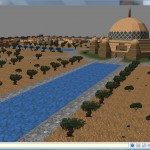
Daggerfall For Free!

The wonderfully huggable Bethesda have released Daggerfall as a free download. Announcement on the Bethesda Blog is here. A huge thanks to Bethesda for taking this step and releasing Daggerfall to the community.

This also means my exploring tools are now available to everyone – not just people who already own Daggerfall. I’m assuming Daggerfall Explorer, Jukebox, etc. will work with the free download of Daggerfall. I will test this out over the weekend. I will also update Daggerfall Scout so it no longer requires the original CD, and instead works with the Zip file released by Bethesda.

Happy days!

Interface Overhaul

Just a quick update today. After realising I spend nearly all my time in Daggerfall Scout with the interface collapsed, I started getting annoyed every time I had to expand the interface to pick another location to explore. If something annoys me, it’s probably going to really annoy someone else.

I’ve started re-working the user interface to provide a nicer experience, and make the location browser more entertaining in itself. I’ll post more about this once the new interface has progressed to a point where it’s screenshot-worthy.

Visual Diary: Climate Processing

The various regions/provinces in Daggerfall can take on a broad range of appearances. From the dry deserts of Alik’r, to the fecund swamps of Totambu, Daggerfall applies local flavour to almost every corner of the map. Different parts of the game world not only have distinct textures for most buildings, but varied plant life as well.

A primary goal for Daggerfall Scout is to faithfully display world maps as they would appear in the game. This is where climate processing comes in. When a city is correctly passed through the climate processer, it will take on the appearance of a desert, swamp, mountainous, or temperate location. Before I could do this, I had to find where Daggerfall itself stored information about a location’s climate, including native plant life.  Today’s Visual Diary steps through the process from research to implementation.

texturearchivemap

A Red Herring

The first place I looked was the map data in WOODS.WLD. Every pixel on the small map data has a corresponding large map chunk. One of the data values in the header for this chunk always corresponds to a ground texture. This seemed like a promising place to start.

After a bit of experimentation, I found the texture value only seemed valid some of the time. In many cases, it was flat out wrong. The city of Sentinel is a good example. The large map chunk for this world pixel reported the ground texture as 302 (temperate), not 2 (desert).

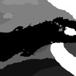
In frustration, I saved out the data into a visual format with intriguing results. Only the far eastern part of the world map, and some of the south, had any definition. The rest was a flat sea of “temperate”. This obviously wasn’t right, so I had to keep looking.

I’m guessing the data visualised to the left is either from an old version of the game world, or used in some as-yet not understood way.

climate226

CLIMATE.PAK

The next place to look was CLIMATE.PAK, which also defines a single pixel that can be overlaid on the standard 1000×500 world map. This data has been known about for some time, but I’ve not looked deeply into how it is used.

The first step was to see what kinds of numbers we’re dealing with. Each climate pixel is a value from 223 to 232. To see this visually, I saved out a series of climate maps, each with a single climate highlighted where it’s used in the world. The screenshot to the left shows climate 226, which covers the mountainous regions of Wrothgaria, Dragontail, and interestingly the Isle of Balfiera. This seemed far more promising. Each climate zone neatly overlaid visually distinct areas of the world.

Once I knew which areas were affected by a particular climate, I fired up Daggerfall and started taking notes. After a few hours of testing, I found Daggerfall always uses the same texture base and plant archive for any given climate value. This allowed me to build a table of which climate pixels uses which texture series for buildings and ground scenery.

If you’ve used Daggerfall Explorer, then you have probably played with my climate texture swaps already. Knowing how to make the swap is one thing. Understanding where the game draws this data from is quite another. With this in place, I was armed to build climate processing into Daggerfall Scout.

regiondev1

Pretty!

New code doesn’t always go to plan. The trees and other ground scenery are processed correctly, but the ground and buildings textures aren’t quite right. Castle Sentinel is particularly attractive.

After quickly fixing a few bugs, things start looking better.

regiondev2-swampregiondev3-desertregiondev4-mountain

Working Climate Processing

Finally, Daggerfall Scout will build a map using the correct building textures and ground scenery for that climate. This has been confirmed by travelling through Daggerfall with Scout running alongside to many locations in each climate band.

The screenshots to the left show maps using swamp, desert, and mountain climates, with distinct scenery in place.

The next step will be to drop in skies. Once again I need to do some research to find out exactly which skies Daggerfall uses where. I’ll put up another visual diary once I’ve made more progress.

Visual Diary: Bright Ideas

Note: This diary is about research into the file formats. Screenshots are from Daggerfall running in DOSBox.

So I’ve been trying to find where Daggerfall stores extra information about flat billboard objects strewn throughout the world. Cows moo, cats meow, and lights… well they light things. For some time I just assumed this information was somewhere unknown in the file formats, and lately I’ve been going mad trying to find it. After not making any progress, I decided that sound effects and lighting properties must be hard-coded based on the texture used.

To test this out, I quickly modified my BSA readers to write back different textures for miscellaneous block flats in BLOCKS.BSA. In the following screenshots the only thing I have modified is the texture index.

lighttest1

Default Scene

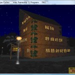
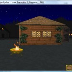
This screenshot is of a General Store facade at night. Note the street light is illuminating the store nicely.

Before taking this screenshot, I have prepared a few modified BLOCKS.BSA files with different flats in place of the defaults. The purpose was to see how Daggerfall handled a simple texture index change. If the light kept flickering, then I knew lights were stored elsewhere and had to keep looking.

lighttest2

Lights Out!

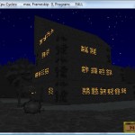
After changing the texture index from a street light to a spell effect, the lighting effect is no longer applied. This is a good sign that I’m on the right track.

lighttest3

Testing A Theory

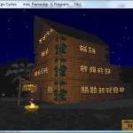
After putting the lights out, it seemed likely that Daggerfall was injecting a standard light source whenever the engine encountered a flat billboard using any texture from TEXTURE.210 (Lights). The billboard is also set to be emissive so that it appears to be self-lit.

To test this out, I replaced the street lights with braziers, and the lights returned. This was enough to prove how lights work, but what about cows and cats? Are billboard sound effects played based on texture alone?

lighttest4

Daisy

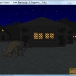
For the next test, I found a nice dark spot with a cow standing near a building. This cow is mooing happily – and frequently!

lighttest5

Flame On

I then replaced Daisy with a brazier. Not surprisingly, the mooing stopped completely and the billboard started illuminating the building behind it.

The lesson learned here is never make assumptions when dealing with Daggerfall’s file formats. Just because it makes sense for something to work a certain way doesn’t mean Daggerfall does it like that. Hard-coded lights and sounds, based on texture index, is a good example of how Daggerfall manages not to conform.

The good news is this behaviour is very easy to reproduce in Daggerfall Scout, and I can stop looking for light and sound definitions in RMB blocks. I can start working on my own lighting model to reproduce those wonderfully atmospheric flickering lights.

I also have a suspicion that Daggerfall scales trees and other objects in a hard-coded manner as well. To test this, I’ll use the same texture modification technique on trees and find out. If the results are interesting, I’ll add to this visual diary.

Gardening For Beginners

After some tinkering in the file formats, I’ve managed to find the location for miscellaneous ground scenery such as trees, rocks, flowers, and so on. While superficially similar to the standard flats records, the scenery records can be region-specific, similar to ground plane textures. This allows the local clutter to take on a native appearance when properly parsed.

Scenery also appears to have different scaling values. A walk through Wayrest’s gardens in Daggerfall shows trees of variable heights. In DF Scout however, these all appear the same dimensions. I’ll keep digging for the correct scaling values and put up a full Visual Diary once completed. For now, here are a few screenshots of Daggerfall Scout with scenery clutter in place, but not yet properly scaled or region processed. This looks very out of place in the Sentinel screenshot below.

Daggerfall Landscaping Wayrest Landscaping 1 Wayrest Landscaping 2 Sentinel Landscaping

Technical Content: The Daggerfall Cache

A companion to the Visual Diary, my Technical Content series will go into more arcane aspects of Daggerfall Scout. Today’s tech-talk is about how XML is used in the Daggerfall Cache to store world files in a format both Humans and computers can read. Before going into more detail, a quick primer for The Daggerfall Cache is required.

After running the Cache Manager to build your personal cache, the following directory structure is built:

-MyDaggerfallCache
	-Default
		+Bitmaps
		+Blocks
		+Maps
		+Meshes
		+Materials
	Default.Provider.xml

In this model, Daggerfall Scout is both a cache provider and a cache consumer. When opening DF Scout, it first locates the Default.Provider.xml file containing a description of subpaths in which content is held. DF Scout is built to understand the layout created by the Default provider. It would be possible to build your own cache provider or consumer. Each distinct cache provider has a unique parent folder and .Provider.xml file describing the layout and builder versions. A consumer program opens its matching provider to locate content.

Each of the content groups has been homogenized into one media type. Where Daggerfall has multiple bitmap formats, the Default builder converts all of these into alpha-enabled PNG files. 3D objects and materials are Ogre .mesh and .material files. Blocks and Maps are saved as pure XML. Starting with a birds-eye view, let’s look deeper at these XML files and how one is used to build a simple location.

When opening a map, DF Scout locates map filenames in this format: RegionName_LocationName.map.xml. So the city of Daggerfall in the region of Daggerfall would be: Daggerfall_Daggerfall.map.xml. A map simply contains layout information for specific blocks. Take a look at Daggerfall_The Ashcroft Graveyard.map.xml below. This map contains only a single location block and a very small dungeon.

<?xml version="1.0" encoding="UTF-8"?>
<Map Name="The Ashcroft Graveyard" NativeType="140" TypeDesc="Ancient Graveyard" HasDungeon="1">
  <Location Identifier="20934" BlocksWide="1" BlocksHigh="1">
    <Block GridX="0" GridY="0" Filename="GRVEAS15.RMB">
    </Block>
  </Location>
  <Dungeon Identifier="20935" BlocksWide="2" BlocksHigh="2">
    <Block GridX="-1" GridY="0" Filename="B0000008.RDB" PlayerStartBlock="0">
    </Block>
    <Block GridX="0" GridY="-1" Filename="B0000006.RDB" PlayerStartBlock="0">
    </Block>
    <Block GridX="0" GridY="0" Filename="M0000000.RDB" PlayerStartBlock="1">
    </Block>
    <Block GridX="0" GridY="1" Filename="B0000003.RDB" PlayerStartBlock="0">
    </Block>
    <Block GridX="1" GridY="0" Filename="B0000001.RDB" PlayerStartBlock="0">
    </Block>
  </Dungeon>
</Map>

The <Map> element encapsulates the document. Its attributes describe the map name as seen on the travel map, a native (Daggerfall-specific) type number, and a descriptive string. Of particular note is the HasDungeon attribute, denoting if the map contains dungeon data or not. This can also be derived by the existence of a <Dungeon&#62 element, but the HasDungeon attribute helps in selectively parsing the XML file using a forward-only reader.

Both the <Location&#62 and <Dungeon&#62 tags encapsulate block layout on a 2D grid. Child <Block&#62 elements describe the filename for each block, and its position on the grid. Now that we’ve seen how maps are laid out, let’s drill down into a block to see how it’s composed. In this case, we’re using GRVEAS15.RMB as it’s the only location block used to represent The Ashcroft Graveyard.

A single block XML file is a bit large to fit comfortably in this post. You can view the entire contents of GRVEAS15.RMB if you wish. The general block structure is as follows:

<Block Identifier="GRVEAS15.RMB">
  <Records RecordCount="17">
    ...
  </Records>
  <MiscMeshes Count="34">
    ...
  </MiscMeshes>
  <MiscFlats Count="2">
    ...
  </MiscFlats>
  <GroundPlane>
    ...
  </GroudPlane>
</Block>

The <Block&#62 element encapsulates all block data. <Records&#62 describes general 3D objects populating the block, such as houses and temples. <MiscMeshes&#62 are 3D clutter such as wagons, fountains, and fences. <MiscFlats&#62 represent 2D clutter like cows, horses, shrubs, and statues. Finally, the <GroundPlane&#62 element details the 16×16 texture square grid under each block. Every block is 4096×4096 world-space units in size, and the ground plane sits under this perfectly, each texture square being 256×256 world-space units.

So what does all this stuff actually mean? Taking the map XML file above, you could render individual components to visit The Ashcroft Graveyard just as it appears in the game. Map layouts range from 1×1 blocks, all the way up to 8×8 blocks for the largest areas such as Daggerfall City. Rendering large areas is just a matter of snapping all the blocks together and rendering their individual components.

Speaking of components, let’s go into the <Records&#62 element in a little more detail. An individual record looks like this:

<Record RotateX="0" RotateY="0" RotateZ="0" TranslateX="-1536" TranslateY="0" TranslateZ="512">
  <Meshes Count="1">
    <Mesh Identifier="750" RotateX="0" RotateY="0" RotateZ="0" TranslateX="-24" TranslateY="0" TranslateZ="24">
    </Mesh>
  </Meshes>
  <InsideMeshes Count="0">
  </InsideMeshes>
</Record>

Attributes of the parent element describes how this 3D object should be rotated and translated into world space, relative to the parent block. <Meshes&#62 describes how many individual 3D objects make up this particular record. For outdoor areas there is typically only one mesh per record, although there are certainly exceptions. <InsideMeshes&#62 plots out how the interior of this record should appear. A good example is any house in Daggerfall – the act of going inside the house loads the inside meshes. This is used extensively in cities to keep locations with interiors nicely grouped. For outdoor scenery, such as GRVEAS15.RMB, the <InsideMeshes&#62 element is rarely populated.

Back to the <Block&#62 itself, <MiscMeshes&#62 and <MiscFlats&#62 are simply strewn relative to their parent. Their transforms are detailed as attributes for each child item.

Each block <GroundPlane&#62 is described by 256 <Square&#62 elments. These are a bit unusual as they don’t specify an image archive, just an image index. This is because there are several viable ground texture sets, based on the terrain (temperate, desert, swamp, and mountain) and the climate (snowing or raining). By applying different texture sets to the meshes and ground planes, Daggerfall achieves a wide variety of appearances using the same 3D data. Each <Square&#62 may also be rotated 90 degrees or flipped in both X an Y axes.

Finally, you will notice the record above specifies a mesh with an identifier of “750”. This tells the engine which mesh to load for that record before applying terrain/weather processing (if required) and transforming into position.

There is much more data held inside a block: doors, trees, action records, NPCs, and more. As these features come online in Daggerfall Scout, I will add them to the XML files exported by Cache Manager. Every time I release a new version of Daggerfall Scout, it’s possible to increment the internal cache version. The program will prompt you to rebuild the cache from your Daggerfall CD so you can explore the new feature.

This Technical Content article has been an overview of how Daggerfall Scout represents blocks and maps using XML. The goal is to stay close to how Daggerfall stores data, while representing it in a Human-readable format. The purpose of this design is to allow technically-minded players to explore the game world using nothing more than Notepad, and never need to deal with complex native file formats.

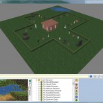
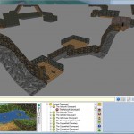
Below, you can see the results of loading The Ashcroft Graveyard in Daggerfall Scout. The engine neatly parses all the XML and loads the appropriate resources.

The Ashcroft Graveyard The Ashcroft Graveyard Dungeon